


Dakar, Senegal
Reuters
Urban scientists on Wednesday launched the first digital map of Africa’s sprawl of slums to expose the true scale of urban poverty and bring services to millions of people.
The “Million Neighbourhoods” project by a team at the University of Chicago aims to map the whole world – eventually – and become a tool for better city planning as mayors decide which areas most need sewers, roads and other basics.
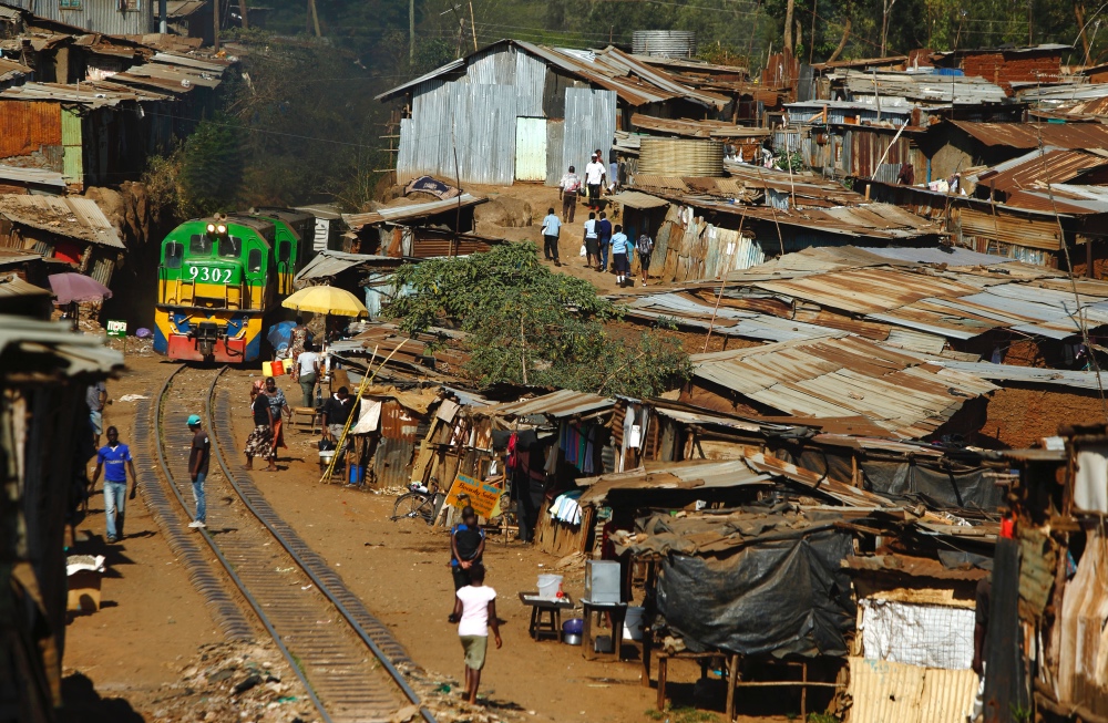
A train passes through the Kibera slum of Kenya’s capital Nairobi on 26th February, 2015. PICTURE: Reuters/Darrin Zammit Lupi
The interactive, online map was created with an open-source database that lets any and all volunteers add the location of roads and buildings in unmapped places.
“Using this map, we can quickly identify the infrastructure deficits of entire cities and pinpoint areas most in need of improvements,” said Luis Bettencourt, director of the Mansueto Institute for Urban Innovation at UChicago.
The map also allows researchers to generate a model of the minimum road network needed to reach every house, which can form a basis for real-life planning, he said.
“The idea is that we will work with people on the ground in cities towards making plans that they think are appropriate,” Bettencourt told the Thomson Reuters Foundation.
About 53 million people in sub-Saharan Africa live in slums, representing about half the urban population, according to a study out earlier this year.
Africa’s urban population is expected to triple in the next 50 years, according to the United Nations, which has set a goal of ensuring universal access to affordable housing by 2030.
The size of slums is generally under-estimated, even by local governments, said a programme coordinator at UN-Habitat, the agency for housing and urban development.
“Slums and informal settlements are not reflected on plans and maps,” said Kerstin Sommer, leader of the slum upgrading unit for UN-Habitat based in Kenya. “We really welcome this initiative. It can be a powerful tool.”
Maps for Central and South America, India and parts of Europe and Asia will come online in weeks, Bettencourt said.