

Bogota, Colombia
Thomson Reuters Foundation
High-tech mapping and mobile phone apps are being used to combat dengue fever in Honduras as the Central American nation struggles to fight the worst outbreak of the mosquito-borne disease on record, medical charity MSF said on Thursday.
Honduras has one of the Americas’ highest incidence rates of dengue, with some 92,000 suspected cases of the infectious disease and 250 deaths recorded this year, according to the Pan-American Health Organization.
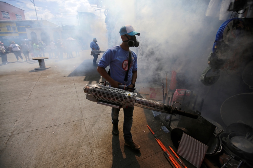
A municipal worker fumigates a market to prevent the spread of dengue fever and other mosquito-borne diseases in Tegucigalpa, Honduras, on 25th July 25. PICTURE: Reuters/Jorge Cabrera
Across the Americas, more than 2.7 million people have caught the virus and 1,206 have died so far in 2019, making this year’s dengue fever outbreak the highest on record in the region, according to latest PAHO figures.
Medical charity Medicins Sans Frontiers said it is using GIS mapping technology and a mobile phone app as key tools to combat the virus and plan their work.
The technology allows health workers to identify dengue hotspots and direct prevention and awareness-raising campaigns to the most-affected areas.
“It allows you to see the evolution of the epidemic in each neighborhood and city and all over the country per day, per week,” said Pascal Olivo, MSF logistics coordinator for Mexico, Honduras and Guatemala.
“We have adapted our strategy accordingly because we can see the evolution of the epidemic on the maps,” he told the Thomson Reuters Foundation.
Using a mobile app to record data, about 20 MSF health workers have been asking residents up to 10 questions about the dengue virus and what is being done to prevent its spread in their neighborhoods.
Questions include whether residents have cleaned water tanks and buckets in their homes – ideal breeding grounds for mosquitoes – if and when local authorities have carried out fumigation, or whether any relative has caught dengue.
The data, along with the GIS maps produced based on data collected by MSF, health authorities and public hospitals, allows health workers to build a timely geographic overview of areas where the virus is most acute and in need of targeting.
As the region faces new mosquito-borne outbreaks, there is a growing need to find new ways to monitor and reduce the spread of infectious diseases like dengue and Zika, which includes using tech and giving affected communities tech-based solutions.
Aid groups are accordingly embracing technology from geographic information system mapping tools, drones and satellite imagery to map areas affected by conflict, disease outbreaks and natural disasters, along with mass vaccination programs.
“In the past two to three years we have seen an evolution in GIS, and it’s used by MSF for almost all emergencies,” Olivo said.