


NASA, the US space agency, recently released published a gallery of remarkable images showing the Earth taken from space. Here’s a few of the stunning display…
NASA, the US space agency, recently released published a gallery of images showing the Earth taken from space. Here’s a few of the stunning display…
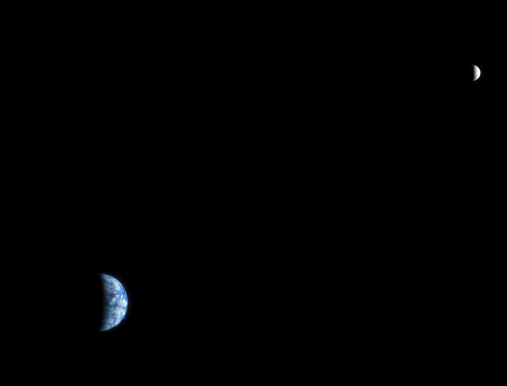
An image of Earth and the Moon, acquired on 3rd October, 2007, by the High Resolution Imaging Science Experiment (HiRISE) camera on NASA’s Mars Reconnaissance Orbiter. PICTURE: NASA/JPL-Caltech/University of Arizona
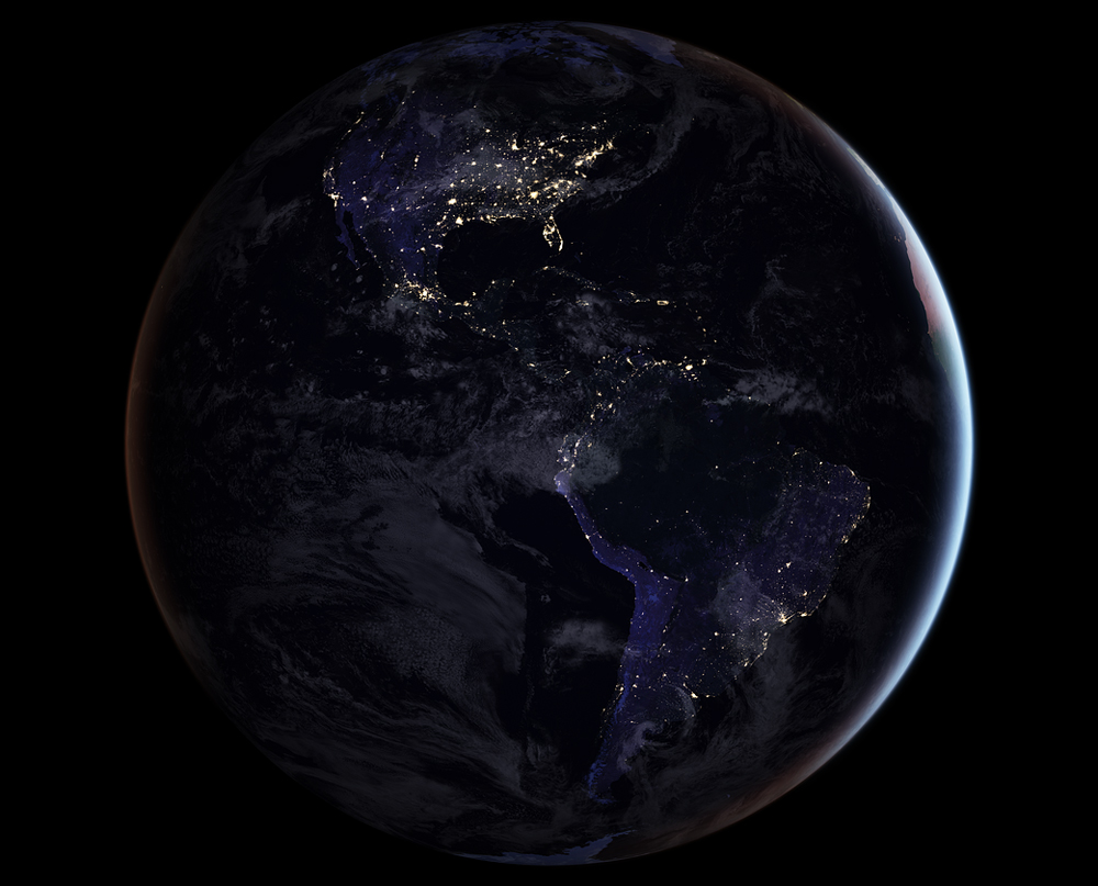
NASA scientists are releasing new global maps of Earth at night, providing the clearest yet composite view of the patterns of human settlement across our planet. This composite image, one of three new full-hemisphere views, provides a view of the Americas at night. PICTURE: NASA Earth Observatory image by Joshua Stevens, using Suomi NPP VIIRS data from Miguel Román, NASA’s Goddard Space Flight Center
An Apollo 10 photograph of Earth taken from about 160,900 kilometres (100,000 miles) away in May, 1969. Visible are many areas of Europe and Africa. Among the features and countries identifiable are Portugal, Spain, Italy, the Mediterranean Sea, Greece, Turkey, Bulgaria, the Black Sea, Libya, Egypt, Saudi Arabia, the Sinai Peninsula, the Nile Delta, Lake Chad, and South Africa. PICTURE: NASA
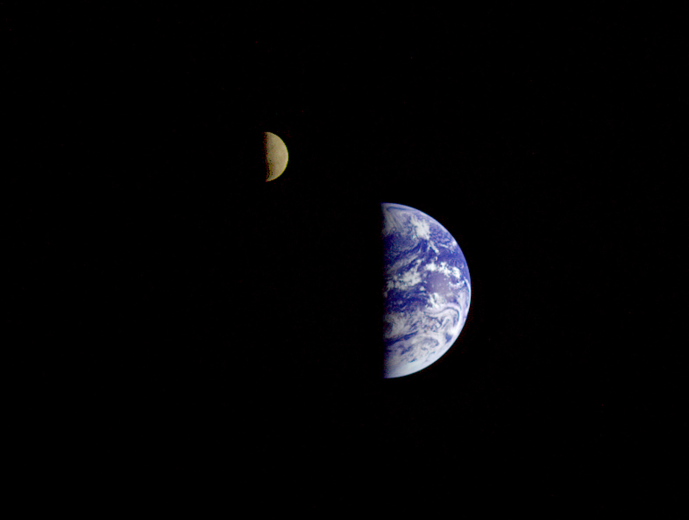
On 16th December, eight days after its encounter with Earth, the Galileo spacecraft looked back from a distance of about 6.2 million kilometres (3.9 million miles) to capture this remarkable view of the Moon in orbit about Earth. PICTURE: NASA
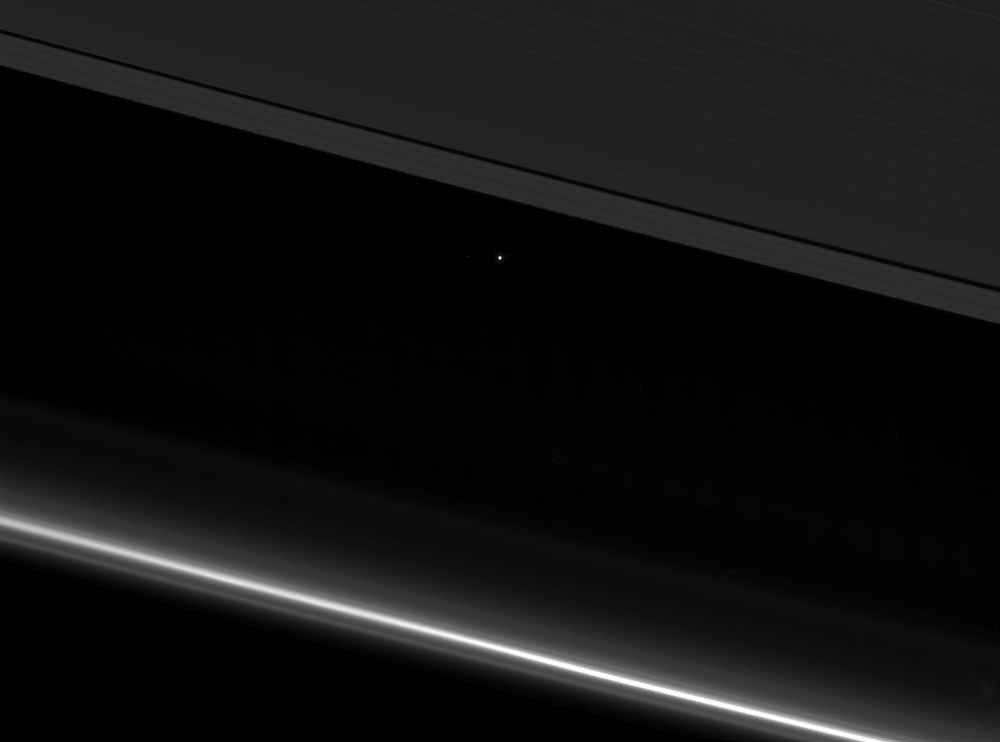
NASA’s Cassini spacecraft captured this view of planet Earth as a point of light between the icy rings of Saturn on 12th April, 2017. PICTURE: NASA/JPL-Caltech/Space Science Institute

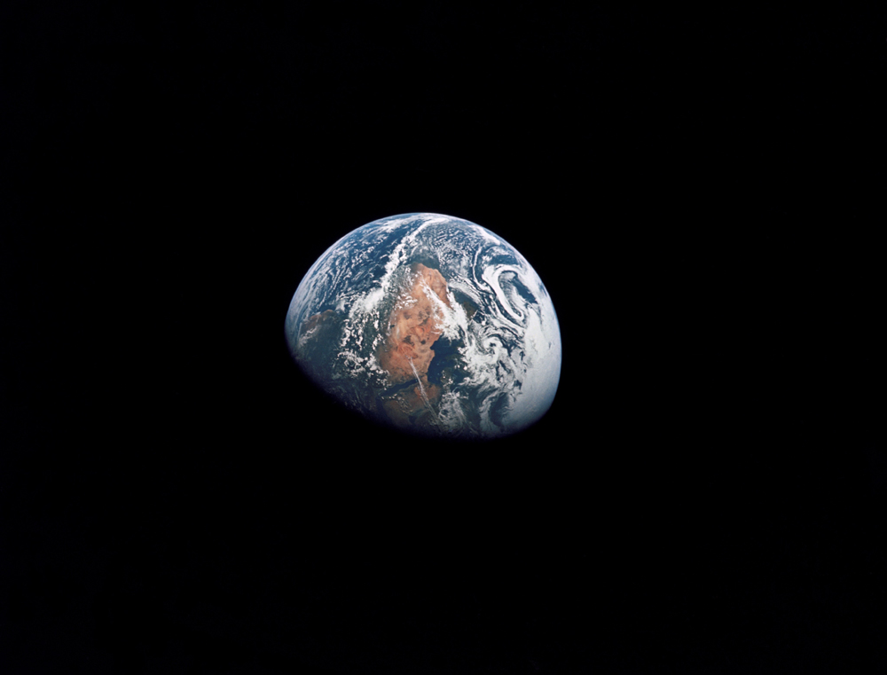
View of the Earth seen by the Apollo 17 crew – astronauts Eugene A Cernan, Ronald E Evans, and Harrison H Schmitt – as they travelled toward the moon in 1972. This translunar coast photograph extends from the Mediterranean Sea area to the Antarctica South polar ice cap. PICTURE: NASA.